.jpg/:/rs=h:98,cg:true,m/qt=q:95)

Maintain a complete, accurate digital record of your buildings for maintenance, planning, and future upgrades.
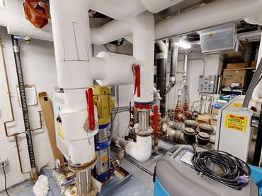
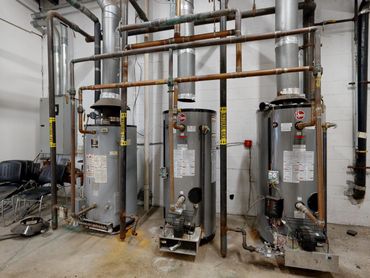
Managing a building without accurate documentation leads to wasted time, unnecessary disruption, and costly guesswork. Our LiDAR scanning services provide facility managers with a precise, accessible digital record of their buildings—so you can locate systems, plan work, and coordinate vendors with confidence.

Our LiDAR scanning services help you:
- Locate plumbing, electrical, and HVAC systems without opening walls
- Reduce downtime during maintenance and repairs
- Share accurate building information with contractors and vendors
- Plan upgrades and renovations using real-world data
- Maintain a long-term record of building conditions
With a digital model of your building, you can:
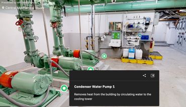
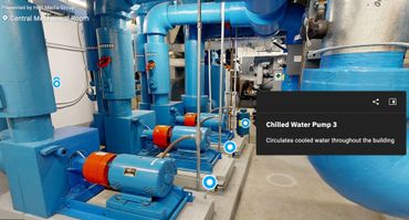
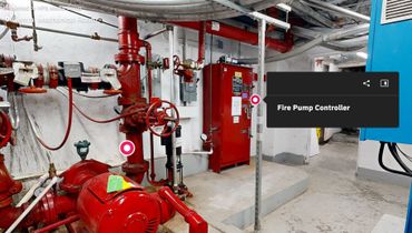
- Remotely inspect mechanical rooms and infrastructure
- Measure spaces and clearances without site visits
- Plan equipment replacements and system upgrades
- Coordinate multiple vendors using the same accurate information
- Reduce uncertainty before any work begins
Deliverables built for real-world facility management workflows:
- E57 point cloud files
- Autodesk ReCap (RCP/RCS)
- Revit models (as needed)
- 3D walkthrough access for remote viewing
- Measurement tools within the model
Ideal for:
- Commercial buildings
- Multi-property portfolios
- Industrial facilities
- Schools and institutions
- Historic and complex structures
Real-world value:
Instead of relying on outdated drawings or guesswork, you’ll have a complete digital record of your building—allowing you to make faster decisions, reduce disruption, and avoid unnecessary exploratory work.
Our facility management services are built on the same LiDAR scanning and documentation workflows used by architects and construction teams—ensuring accuracy, reliability, and long-term value.
Infrastructure accessible without stepping on-site
Looking to create a digital record of your building?
Let’s talk about your property, your needs, and how scanning can support your long-term operations.